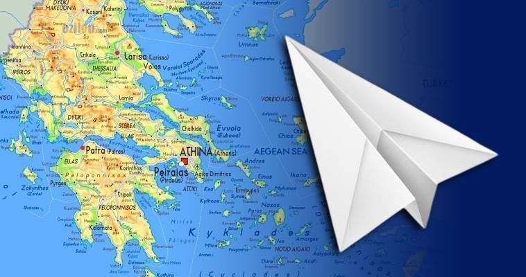
The Greek seas and their magical history
The Greek seas and their magical history
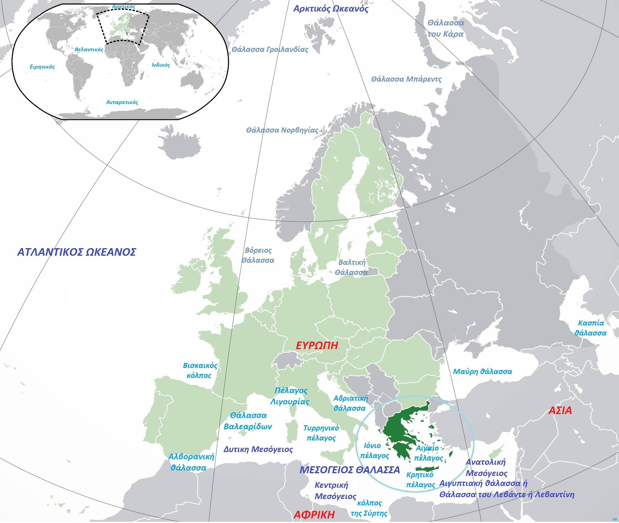
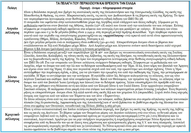
Our country, in the eastern basin of the Mediterranean, at the crossroads of three continents, consisting of a peninsula and a multitude of islands, islets, rocky islets and rocks, is surrounded by 3 large seas (Aegean, Ionian & South Cretan), has five smaller and 8 individual marine areas. According to nautical geography, an ocean is a very large wet surface with salt water, named so by Herodotus after the mythical God Oceanus.
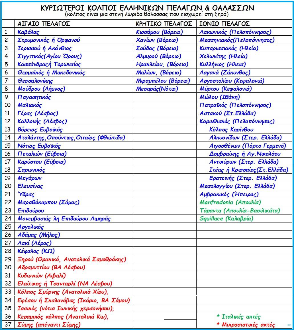
Initially, there were three oceans (Pacific, Atlantic and Indian), while later both of the Earth's poles (Arctic and Antarctic) were added. The oceans in total cover almost three-quarters (71%) of the Earth's surface. Large areas of water, but smaller than oceans, that are formed between islands or large areas of land, are called seas (e.g. Mediterranean). When their area is smaller, they are called pelages (Ionian, Aegean, Cretan), while when their area is strongly limited by land, then it is called a gulf and our country has 57 large gulfs.
The Greeks are a maritime people and since ancient times they have been inextricably linked to their seas and oceans. They were born, raised and created a civilization in their seas, and through them they transmitted it to neighboring countries and continents.
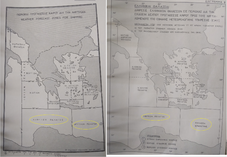
Of the three seas surrounding Greece, the largest, the Aegean archipelago, contains five large "pelagic" areas and eight smaller ones, seas or gulfs, and this is because the island inhabitants of the Greek area all wanted to have their own sea.
So they took names from mythology and geography and gave them to their neighboring parts of the Aegean Sea and so we have the North Cretan Sea, the Carpathian Sea, the Rhodes Sea, the Kastelorizo Sea, Ikaria, the Samos Sea, the Myrtoan Sea, the Euboean Sea and the Thracian Sea. This subdivision seemed particularly useful in “meteorology”, which because each sea area has its own characteristics and weather can and does give more accurate forecasts in these geographical areas.
The formation of our seas.
From the Upper Cenozoic era, that is, the last 23 million years approximately, and the Lower Miocene (Aquitaine), that is, 22,5 million years ago, and the ice age, Europe, Africa, and Asia were united, and in the Mediterranean there were two separate lagoons. One to the west and one to the east. On the eastern side, the part that was not covered by ice, constituted the land of Aegis, which included present-day Greece and part of Asia Minor.
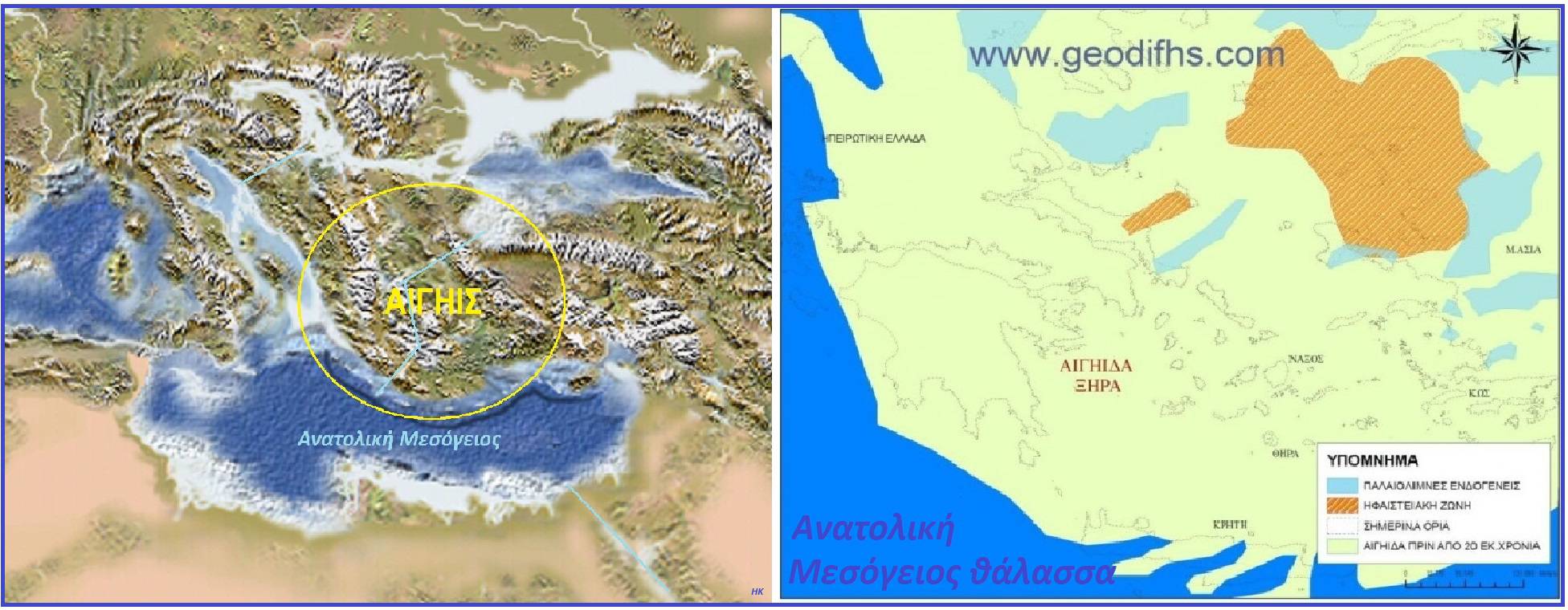 The country was crossed by the Aegean River, which came from the Black Sea and flowed into the area west of Crete, forming a sea. The Adriatic, which poured its waters north of Corfu, and the Nile River also ended in the same sea.
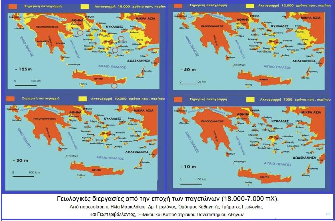
When the ice began to melt, enormous geological changes occurred, resulting in the destruction of most of the Aegeus. Initially, subsidence-uplift of the land and later by earthquakes-volcanoes. The “Mediterranean” was flooded with the waters of the Atlantic and thus the three seas that surround Greece were formed.
According to the IMO (International Hydrographic Organization, Special Publication No 28, Limits of Oceans and Seas), the points that define the limits of the Aegean and Ionian Seas since 1952 are as follows:
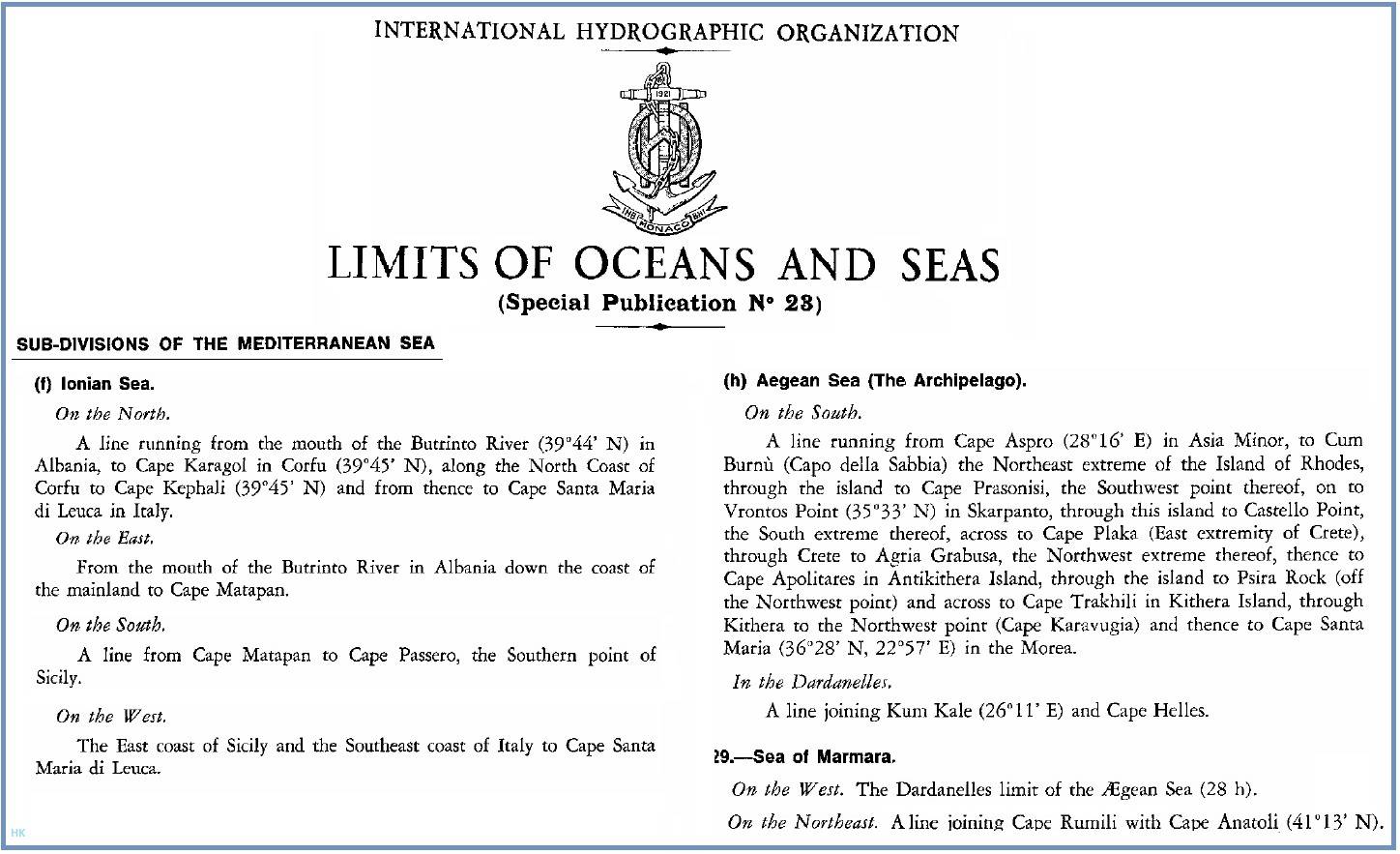
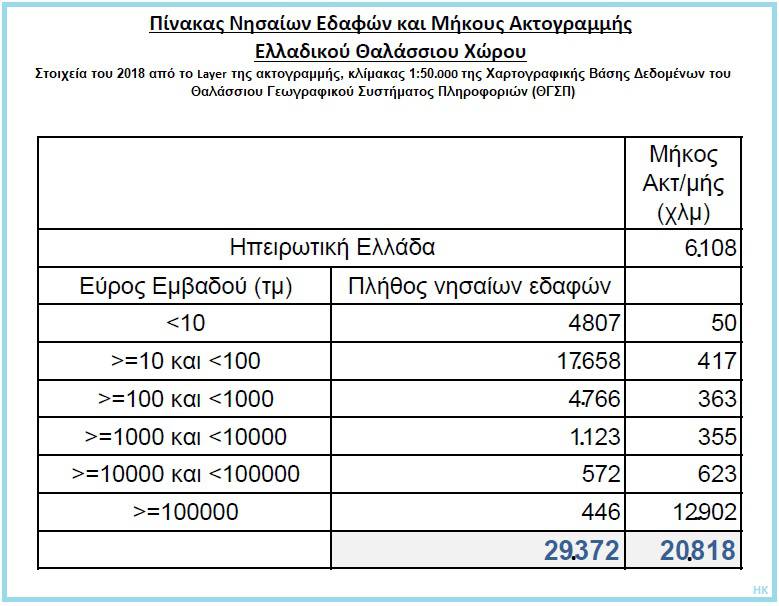
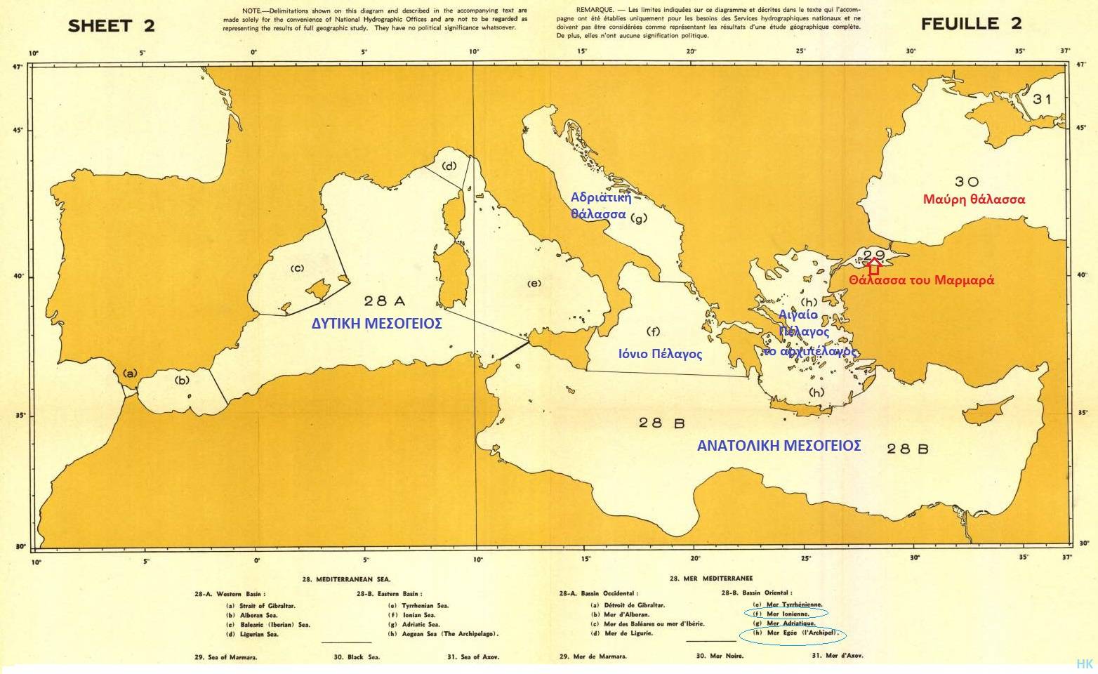 Because the Aegean has an extremely large number of islands, islets, islets and rocks, a total of 29.372 islands, as well as five individual “seas”, it was rightfully named by all ancient geographers and cartographers as “Archipelago”. A term derived from the words “archon” and “pelagos” and used since the Middle Ages, on all maps published. Even in 1952, the name mentioned in the text of the internationally recognized IMO publication and appearing on its maps, is “Mer Egee (L' Archipel)”.
![]()
These islands of the Aegean Sea were formed and shaped by its waters and therefore all the islands between mainland Greece and the Asia Minor coasts (Greek and Turkish), owe their existence to this sea. In simple words: our islands sit on the land of Aegis and not on the continental shelf of the Asia Minor coast!
The Aegean archipelago
Our Archipelago has five smaller pelagic regions: Thracian, Ikarian, Myrtoan, North Cretan & Carpathian.
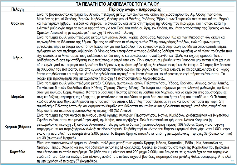
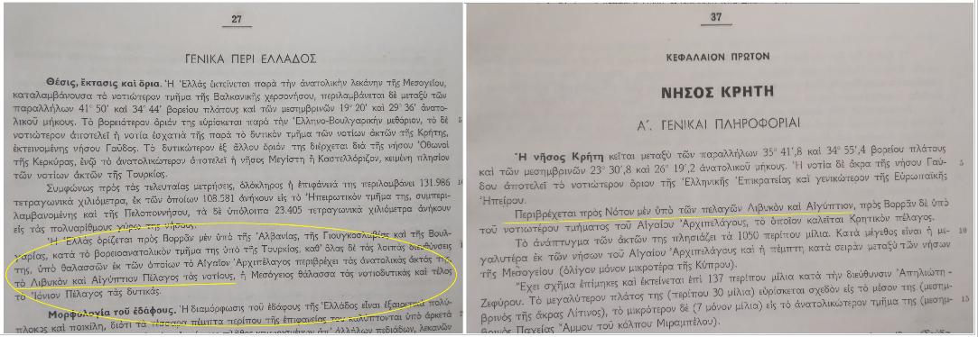
Specifically for the Cretan Sea, this includes the sea area surrounding Crete and is divided into two, the northern and the southern. In the past, the northern Cretan was called the Cretan Sea and the southern was divided into the Egyptian Sea to the east and the Libyan Sea to the west. However, for reasons of simplicity and to avoid misinterpretations and misunderstandings, the sea area south of Crete is now referred to as the South Cretan Sea while the northern one is the North Cretan Sea and these names, from 1990 onwards, are reflected on all paper and electronic nautical charts of the Hellenic Navy.
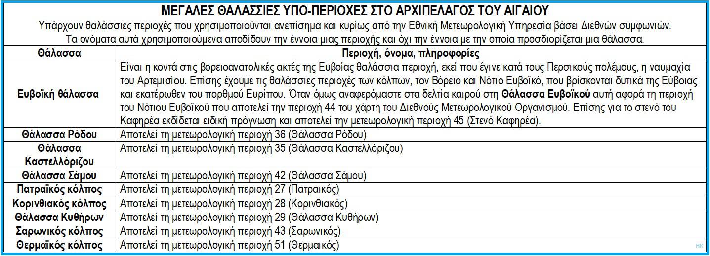
 In addition to the seas mentioned above, there are several other relatively large sea areas that are used unofficially, mainly by the National Meteorological Service. These names do not convey the meaning by which a sea is defined.
This establishment of additional sea areas is very useful and facilitates the identification of an area. However, the boundaries of these areas should be easy to describe, to draw and above all they should be identical to those of other sea areas. They should be common to everyone who writes or describes a place, a region or a sea.
International security system and maps
In 1972, at the initiative of the International Hydrographic Organization (IHO) and the International Maritime Organization (IMO) in London, it was decided and in 1974 the World-Wide Navigational Warning Service (WWNWS) was created, which established the Global Maritime Distress and Safety System (GMDSS).
This plan was approved in 1988 and came into force in 1992. Since then, WWNWS has coordinated all government agencies around the world, namely the Maritime Safety Administrations (MSAs) that provide information on the safe navigation of ships and the correction of nautical charts, the National Meteorological Services for weather warnings and forecasts, the Rescue Coordination Centers (RCCs) in the event of a vessel in distress, and the International Ice Watch (IIP) for information on the presence of icebergs in the oceans.
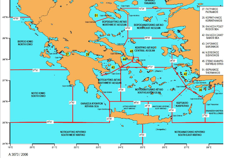
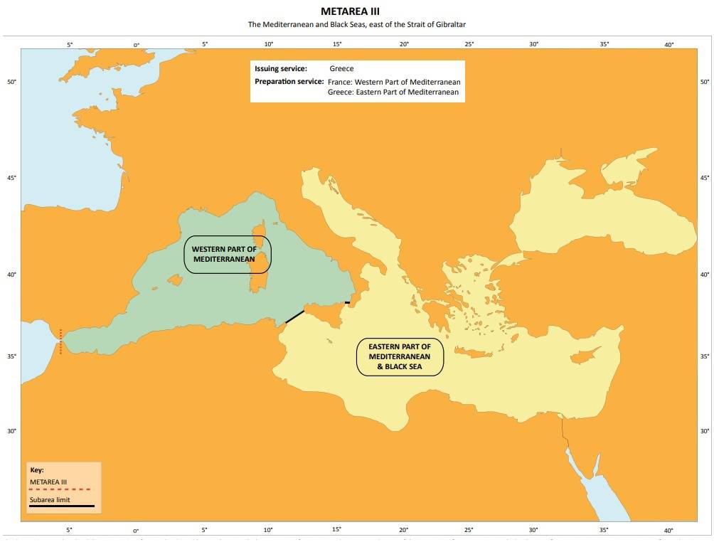
For the better distribution of this information, the globe was divided into 21 areas (geographical) called NAVAREA (transmission of navigational warnings) and METAREA (transmission of meteorological information) and each area has a state in the role of Coordinator. Each area is subdivided into sub-areas (sub-areas) whose boundaries usually coincide with the EEZ of the coastal state,
The role of Greece
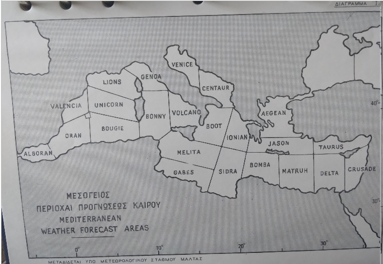
The Mediterranean and the Black Sea belong to NAVAREA III (Area III) with Spain as coordinator, while for the “Meteorological Information METAREA III” region, the coordinator is, for the western part, the meteorological service of France, while for the eastern part, the corresponding one of Greece.

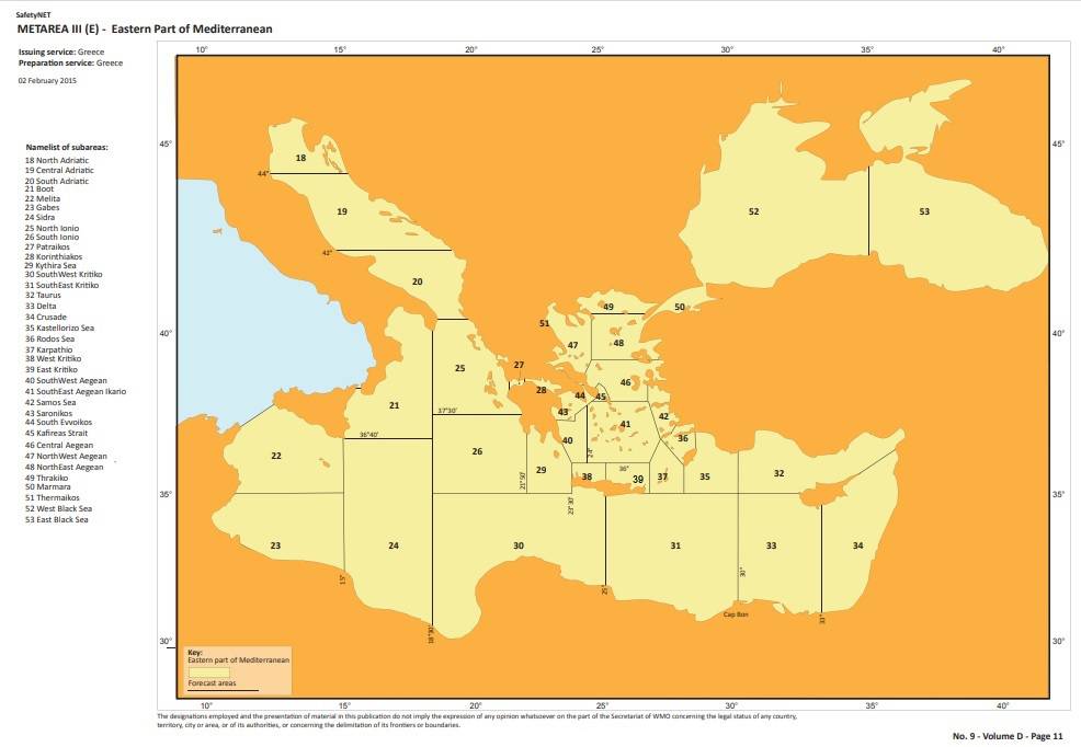
METAREAs are usually divided into smaller sea areas for ease of procedures. In the Eastern Mediterranean, for the issuance of meteorological forecasts and updates, there are 36 sub-areas.
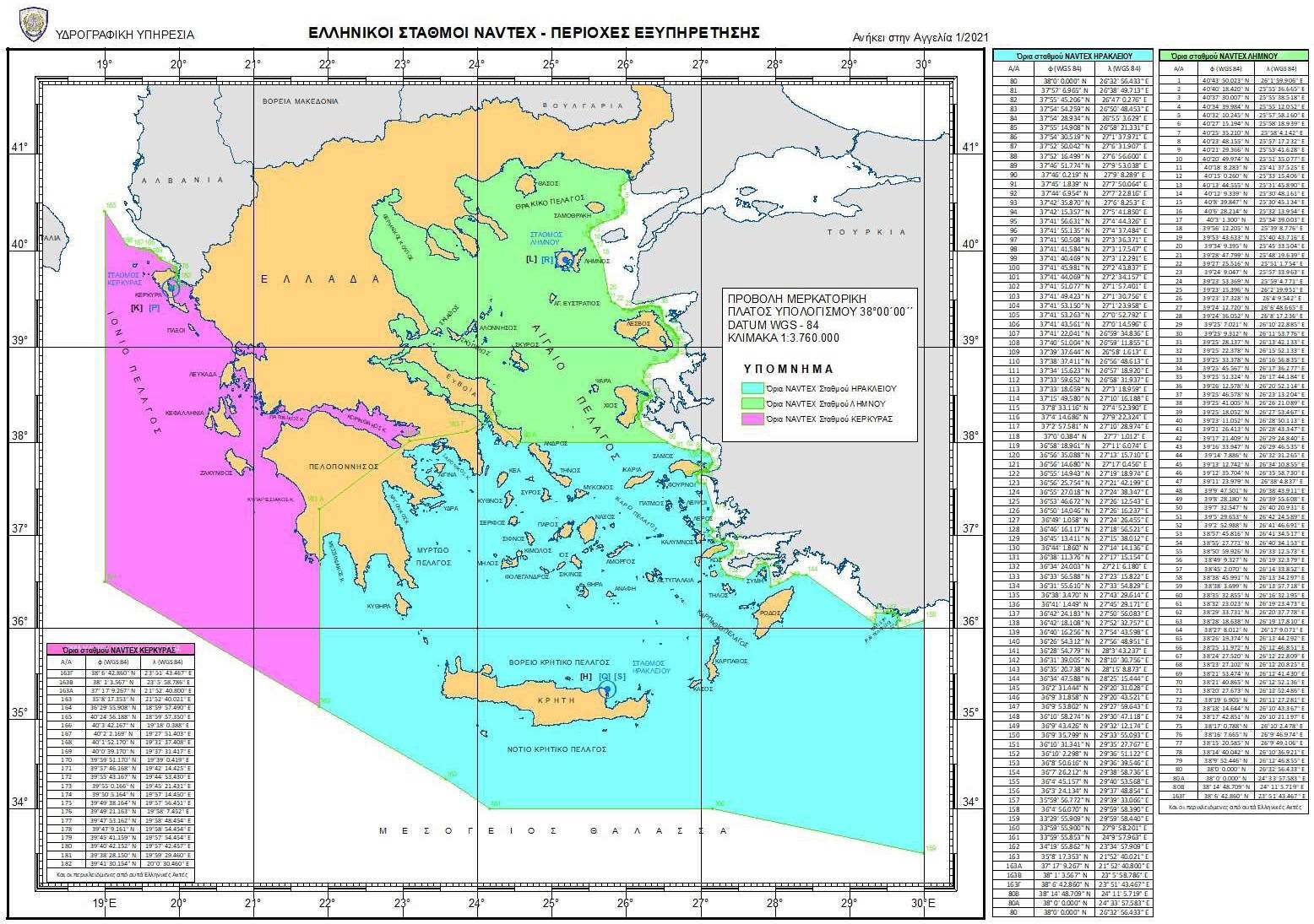
In our sub-region, the role of coordinator for the collection, processing and transmission of NAVTEX messages (originally the words NAVigational TEXt) is played by the Hydrographic Service, which collaborates closely with the co-competent services, the Hellenic Maritime Service and the Operations Room of the Coast Guard.
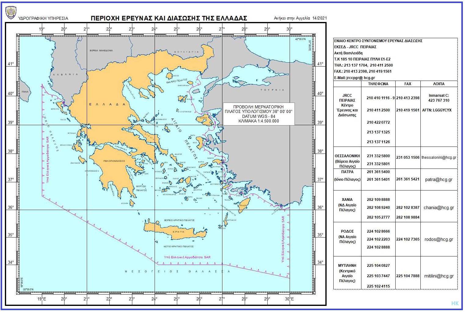
The outer limits of the Greek maritime areas coincide with the internationally established limits of the Athens FIR area, as well as with those of the area of responsibility for Search and Rescue (SAR) in case of maritime and aviation accidents. The Greek SAR area of responsibility is further divided into six sub-areas, with the corresponding sub-centres in Piraeus, Thessaloniki, Patras, Chania, Rhodes and Mytilene.
Joint understanding
To summarize, our country is one that God endowed with a multitude of islands and seas. These seas and our oceans must continue to be the channel for the transfer of culture, the spirit of love and humanitarian values.
 However, because there are many, they are frequently mentioned by many bodies, because every teacher, writer, journalist, researcher or map publisher, from official maritime to tourist and school maps, mentions and displays the same areas with different names, it is considered necessary to coordinate, perhaps by the Ministry of the Interior, all the competent bodies, so that the names of the maritime areas with their boundaries can be re-checked, stabilized and made public.
Special care must be taken by the Ministry of Education so that all educational aids, and especially works that receive state or EU funding, use the same names and have the same boundaries. It is not possible for us to see the same names with different boundaries in every book, treatise or article, nor for us to still have books and maps that have the South Cretan Sea divided and refer to it as the Libyan or Egyptian Sea.
Such a thing, apart from confusion, can only create problems. We have never had a problem with our neighboring states to the south and our relations have been and are good. However, because our region is in the SE Mediterranean basin, where many interests exist and many activities are taking place and will take place, a problem may arise and it is good to prevent this.
It is not possible to see in every book, treatise or article the same names with different boundaries, nor to have books and maps that have the South Cretan Sea divided and refer to it as the Libyan or Egyptian Sea. Something like this, apart from confusion, can only create problems. When we say “Ikarian Sea” we automatically think: Ikaria is in Greece, therefore the sea is Greek! What will we say if we ourselves give them names that refer to other states? Is it logical?
Of course, we have never had a problem with our neighboring states to the south and our relations have been and are good. However, because our region is in the SE Mediterranean basin, where many interests exist and many activities take place and will take place, perhaps a problem may arise in the future and it is good to prevent this.